How has an area in your Canadian family history changed?
Maps from the 1:50,000 scale National Topographic Series, covering the years 1905 (?) to 2012 and representing all Canadian provinces and territories, are now online through Canadiana.ca /.
The nearly 22,000 Canadian maps, digitized by McGill University Library, depict in detail ground relief (landforms and terrain), drainage (lakes and rivers), forest cover, administrative areas, populated areas, transportation routes and facilities (including roads and railways), and other human-made features such as buildings, power lines and dams.
As there are maps for different years you can see changes to the landscape, although there are gaps in the collection.
At the 1:50,000 scale (1 inch to 0.79 miles) roads are depicted but not named.
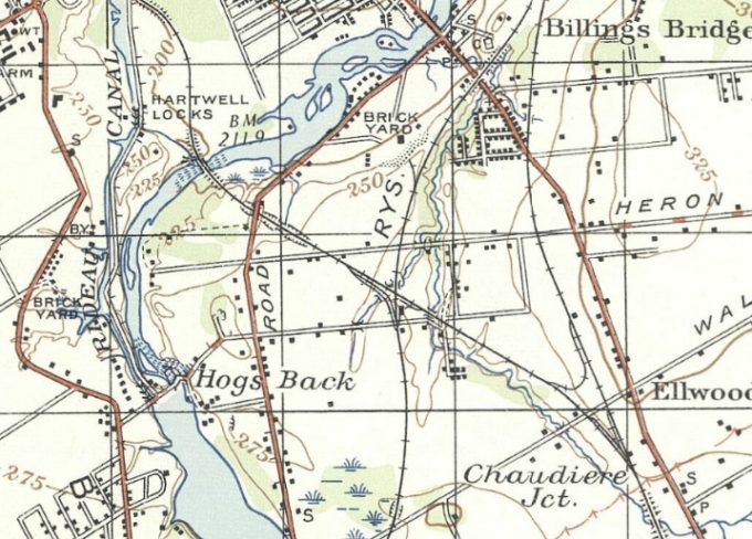
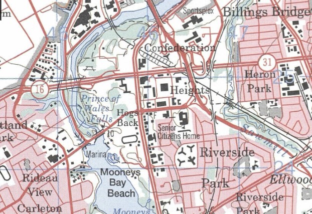
The Ottawa extracts below are for 1950, the earliest and 1998, the latest I could find for the area. In between are maps for 1958, 1968, 1976, 1983, and 1987.
I’ll have to go explore those Ottawa maps – I grew up in the far west end, so it will be cool to see how it has changed over the years 🙂