MyHeritage has expanded its genealogical offerings with the release of two passenger list collections on 2 January 2026. While these records have been available through Ancestry and Findmypast, their presence on MyHeritage provides another access point for researchers.
The United Kingdom and Ireland, Outgoing Passenger Lists, 1890-1960, contains over 23 million records of individuals departing from UK and Irish ports, while the Incoming Passenger Lists, 1878-1960, document arrivals with more than 15 million records. Records typically include names, birth dates or ages, residences, departure and arrival details, and vessel names. Record images are linked.
While this doesn’t represent newly discovered historical material, it does represent increased accessibility—a straightforward expansion that offers convenience for researchers already working within MyHeritage’s platform.
Note that this is based on information posted by MyHeritage; I was unable to test the collections. At the time of writing, there was an issue with the MyHeritage website, including problems entering information into the search box. Patience.
Latest MyHeritage news, not in the review, is that parent company, the private equity firm Francisco Partners, hired Jefferies in late 2025 to explore a potential sale of the genealogy giant for around $1 billion, testing an exit strategy after acquiring it in 2021 for $600 million.
New Year Honours
The January 2026 appointments to the Order of Canada include 63 individuals across three levels: 6 Companions (C.C.), 15 Officers (O.C.), and 42 Members (C.M.). While the Order aims to reflect the “tapestry of Canadian life,” an analysis of the 2026 list reveals several distinct patterns and biases:
1. Geographic Concentration
Based on population, there is a significant over-representation of individuals from Ontario and British Columbia. The North. Quebec and the Prairies are under-represented.
2. Institutional and Academic Bias
The list leans heavily toward “elite” professions. A large majority of the recipients hold PhDs, MDs, or Law degrees and are affiliated with major research universities.
3. Career-Stage Bias (Promotions)
The Order of Canada often recognizes lifetime achievement, which naturally skews toward older demographics.
4. Representation of Diverse Groups
The 2026 list shows a conscious effort toward inclusivity compared to historical cohorts, though some gaps remain.
5. Philanthropy
A notable presence as a primary or secondary reason for appointment.
Genealogy
Alamin Proton Rahman, is appointed a Member of the Order of Canada. A renowned genomics expert and Memorial University professor, he is transforming arthritis care in Canada. Notably, he created the Newfoundland Genealogy Database to trace genetic disease links across generations. As a provincial scientific advisor, he played a key role in shaping Newfoundland and Labrador’s COVID-19 response, and in advancing public health and medical research.
In the UK New Year Honours, the British Empire Medal was awarded to William Macfarlane Lawson, Genealogist, for services to the community in the Western Isles.
The British Association for Local History presents a talk exploring the research behind the Historic Towns Trust’s London on the Eve of the Great Fire project. Find out how historians reconstruct the city’s built environment just before 1666. It offers insight into the sources, methods and challenges involved in mapping streets, buildings and placenames across the early modern metropolis.
Backadder – the final scene
Blackadder – the making of the final scene
Thanks to the following individuals for their comments and tips: Anonymous, Alison, Basil Adam, Brenda Turner, Charles Godwin, Christine Jackson, Dianne Brydon, Gail, John Estano DeRoche, Nancy Cutway, Teresa, Sunday Thompson, Victor Badian, Unknown.
Thereport on which it was based was delivered to LAC on 31 March 2025. What should one read into the nine-month delay?
As part of the ongoing response, there’s mention of “Launch of a project in collaboration with Internet Archive Canada to digitize 80,000 public domain publications, dating from 1322 to 1920.”
The Internet Archive Canada announced it on Canada Day 2024, stating, “Stay tuned for more updates on this exciting project, and join us in celebrating this significant milestone in the preservation of Canada’s documentary heritage.”That’s 18 months ago. Promises, promises. Where’s the product? Unless it’s buried, I couldn’t find anything among the many Canadian contributing organizations listed in the Internet Archive’s Top Collections.
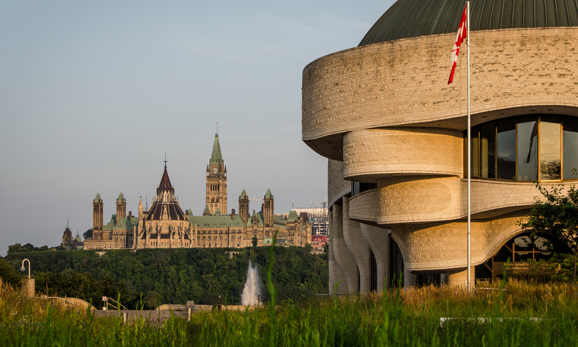
Two hundred years, from a colonial perspective. On 16 August 1826, General George Ramsey, 9th Earl of Dalhousie and Governor General of British North America, wrote to Lieutenant-Colonel John By advising of his “purchase” of land for the Crown that contained the site of the head locks for the proposed Rideau Canal on the Ottawa River. <HSO Blog Post>
A good New Year’s Resolution for celebrating in 2026 would be to dip into one or more of these ten highly regarded books on Ottawa’s history. They range from modern, comprehensive histories to 19th-century primary accounts.
Essential General Histories
“Ottawa: An Illustrated History” by John H. Taylor (1986)
Considered one of the definitive modern histories of the city. It traces Ottawa’s evolution from a rough military outpost and timber town into a national capital, weaving together political, social, and geographical history with over 150 historical photographs.
“Ottawa—Making a Capital” edited by Jeff Keshen and Nicole St-Onge (2001)
An academic but accessible collection of 24 essays. It covers diverse topics, including Indigenous pre-contact history, the Voyageurs, the Great Fire of 1900, and the development of the civil service.
“Ottawa Old and New” by Lucien Brault (1946)
A classic reference work by a former professor and historian of the city. Although older, it provides detailed factual information on the city’s early development and infrastructure.
The Bytown Era & Early Settlement
“Ottawa Stories: Trials and Triumphs in Bytown History” by Cliff Scott (2014)
A more narrative-driven look at the “wild” days of Bytown. It features stories of characters like Big Joe Mufferaw, early political scandals, and the violent “Shiners’ War” between rival lumber factions.
“Thomas Mackay: The Laird of Rideau Hall and the Founding of Ottawa” by Alastair Sweeny
This biography focuses on one of Bytown’s most influential figures—the man who built the Rideau Canal locks and Rideau Hall. It offers a unique perspective on the city’s industrial and architectural origins.
“Bytown at Your Fingertips” by Robert Serré (2011)
A detailed guide to the early years of the settlement, focusing on the people and streets of the original Bytown community before it was renamed Ottawa in 1855.
Primary Accounts & Historical Perspectives
“Recollections of Bytown and its Old Inhabitants” by William Pittman Lett (1874)
Written by Ottawa’s first City Clerk and unofficial “bard,” this provides a firsthand, often poetic account of life in the town during its transition from Bytown to the capital.
“Records of the Rise and Progress of the City of Ottawa” by Gertrude Van Cortlandt (1858)
One of the earliest published histories of the city, written shortly after Ottawa was chosen as the capital.
Specialized Topics
Since Time Immemorial “Our Story” : the Story of the Kitigan Zibi Anishinàbeg by Stephen McGregor (2004) Indigenous perspective
“The Mile of History” by Lucien Brault (1981)
A focused look at Sussex Drive and the historical heart of the city’s market and parliamentary district.
An internet search will find many more, including fiction set in Ottawa. The Ottawa Historical Society has published a broad range of Ottawa history, including the Bytown Pamphlet series, now comprising 129 volumes.
Perhaps your favourite, maybe even your own publication, is missing. Don’t hesitate to add to the list in the comments.
To end the year, an acknowledgement and thanks to the organizations that supported the blog by providing complimentary access to their services during the year. In alphabetical order:
Ancestry for access to full Ancestry.ca, newspapers.com and Fold3 subscriptions.
FamilyTreeWebinars for full access to familytreewebinars.com.
Findmypast for full access to findmypast.com.
MyHeritage for full access to MyHeritage.com.
TheGenealogist for full access to thegenealogist.co.uk.
The FreeBMD database was updated on 29 December to contain 294,843,900 unique entries. Years with more than 10,000 additions are: births (1993-96); marriages (1995-96); and deaths (1991, 1994, 1996-97).
Thanks to the nearly 2,000 volunteers who have contributed to FreeBMD over the past year for continuing to add entries. Find out who’s behind the scenes and more in the FAQ. Thanks also for the new website with improved capabilities at https://www.freebmd2.org.uk/
Between December 2024 and 2025, there were 2,744,631 unique additions in the mid-1990s. Continuing at that rate, the project would be completed to 1999, in a bit over 3 years.
AI, DNA, Canada, the UK, and more are scheduled as 2026 topics by Legacy Family Tree Webinars. They’re trying something new with Deep Dives. Register for the items that interest you and be reminded as the event approaches.
 MyHeritage has expanded its genealogical offerings with the release of two passenger list collections on 2 January 2026. While these records have been available through Ancestry and Findmypast, their presence on MyHeritage provides another access point for researchers.
 Two hundred years, from a colonial perspective. On 16 August 1826, General George Ramsey, 9th Earl of Dalhousie and Governor General of British North America, wrote to Lieutenant-Colonel John By advising of his “purchase” of land for the Crown that contained the site of the head locks for the proposed Rideau Canal on the Ottawa River. <
 The FreeBMD database was updated on 29 December to contain 294,843,900 unique entries. Years with more than 10,000 additions are: births (1993-96); marriages (1995-96); and deaths (1991, 1994, 1996-97).